GPS Wrist
Our products
Your shopping cart
No products

- Description
- Accessories
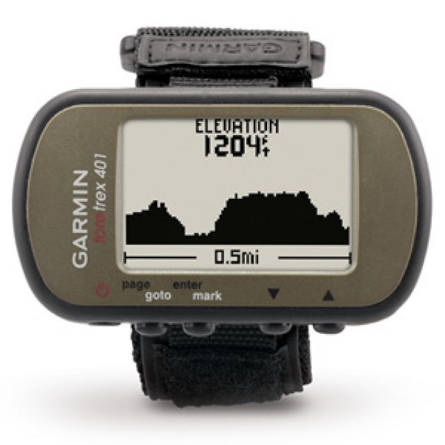
Foretrex 401 is a slim wrist-mounted GPS navigator perfect for outdoor activities that require the use of both hands. It combines a high-sensitivity waterproof GPS receiver, electronic compass and barometric altimeter into a lightweight device ideal for hikers, skiers and campers. To share data easily, you can connect Foretrex to your computer with USB or just send data wirelessly to another device.
Retrace Your Steps
You'll never worry about getting lost with Foretrex 401. It keeps track of your path and displays it as a dotted trail on the screen. Just turn on the TracBack® feature and you can retrace your path back to where you started. Keep track of your bearing and altitude with Foretrex 401's electronic compass and barometric altimeter. You can save locations in memory as waypoints, so you always can find your way back to any important place, such as your campsite or vehicle. And it boasts up to 17 hours of battery life and replaceable AAA batteries.
Track Your Data
Foretrex 401 lets you create and store routes to all of your favorite places and provides other helpful information, including a trip computer, sunrise/sunset times and hunting and fishing information. For even more data, connect Foretrex 401 to a wireless accessory, such as a heart rate monitor or cadence sensor, or clip it on your bike with a mount. To keep track of your trip, connect your Foretrex to your computer with USB to store your waypoints, routes and tracks, or share them wirelessly with another Foretrex 401.
Get Connected
With a simple connection to your computer and the Internet, you can get detailed analysis of your activities using Garmin Connect™. It allows you to view your activities on a map using Google™ Earth. Explore other routes from more than 12 million customers and share your experiences on Twitter® and Facebook®.
Plan Your Next Trip
BaseCamp™ lets you view and organize your maps, waypoints, routes, and tracks and send them to your device. It displays topographic map data in 2-D or 3-D on your computer, including contour lines and elevation profiles.
Representations


NAUCOM - Equipamento de Navegação e Telecomunicações, Lda. © 2024 , All rights reserved . Legal Notice