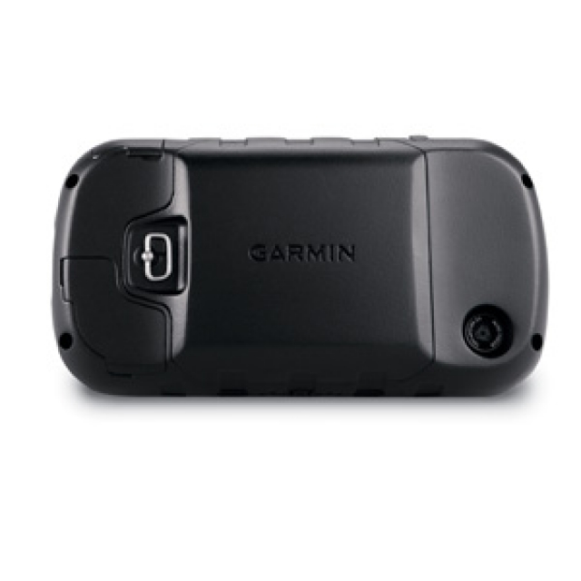
Handheld GPS
Our products
Your shopping cart
No products


- Description
- Accessories
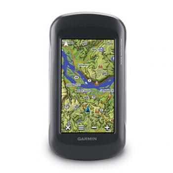
Big, Tough GPS with Preloaded Topographic Maps
- 4" dual-orientation, glove-friendly touchscreen display
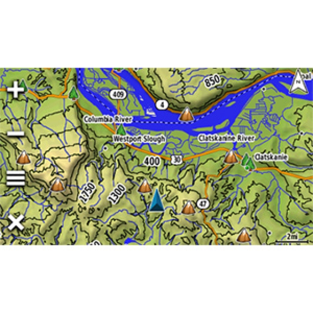
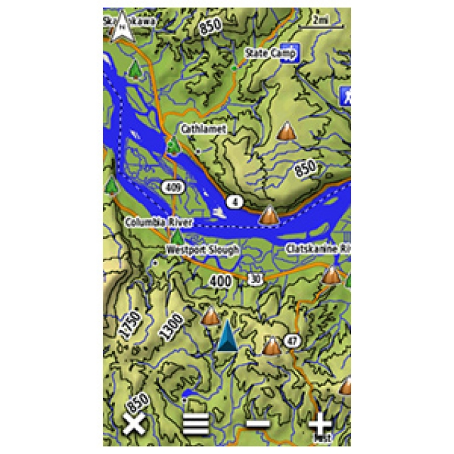
- Preloaded TOPO U.S. 100K maps
- 5 MP autofocus camera
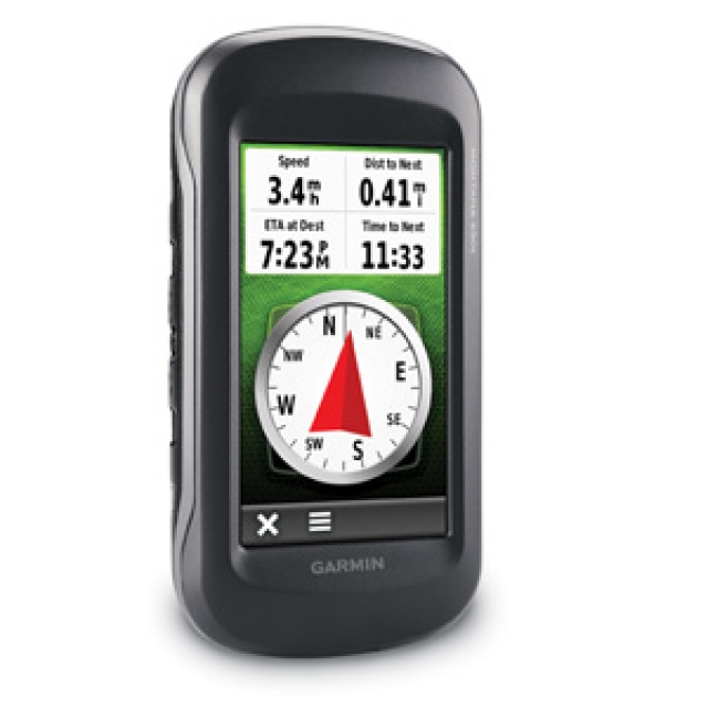
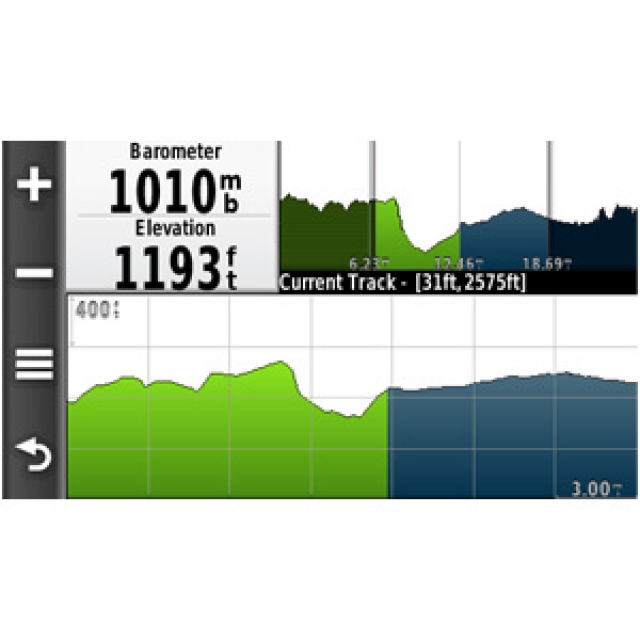
- 3-axis compass with barometric altimeter
- Uses rechargeable lithium-ion battery pack or AA batteries
Take it hiking. Take it hunting. Take it on the water. Montana 650t features a bold 4" color touchscreen dual-orientation display and TOPO U.S. 100K maps, supports multiple mapping options such as BirdsEye Satellite Imagery, and it has a 5 megapixel camera to boot.
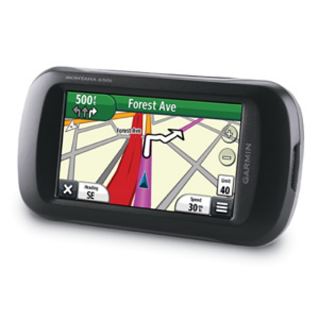
Montana has a 3-axis tilt-compensated compass and barometric altimeter. Pair it with an auto mount and City Navigator NT® map to get spoken turn-by-turn driving directions.
Enjoy the View
Montana 650t has a vast 4" sunlight-readable touchscreen display, giving you crystal clear enhanced colors and high-resolution images. Its easy-to-use interface means you’ll spend more time enjoying the outdoors and less time searching for information. Montana 650t is built to withstand bumps, dust, dirt, humidity and water. It's right at home on a boat, RV or ATV.
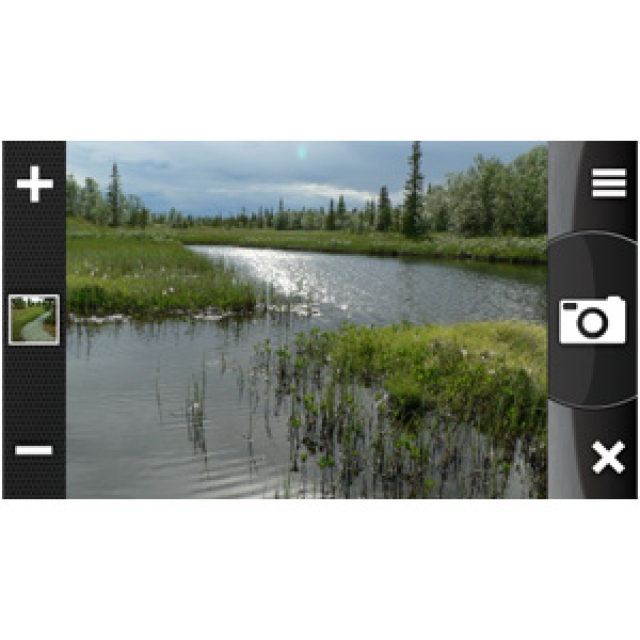
Take Geotagged Pictures
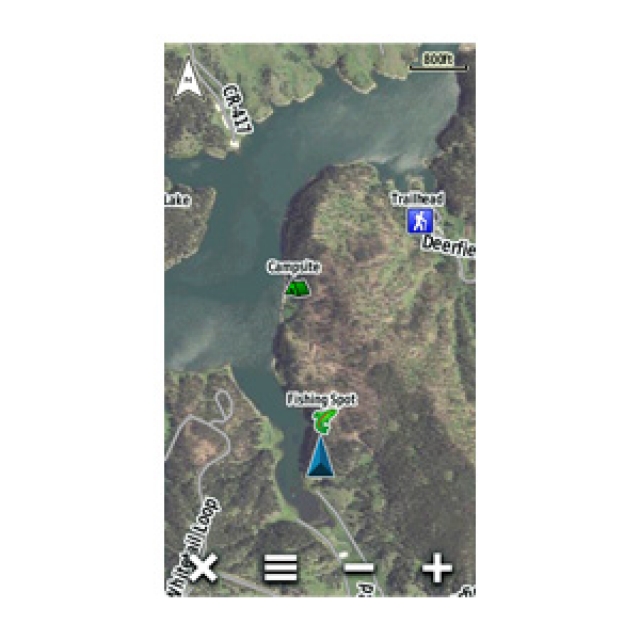
Capture locations and memories with Montana 650t’s 5 megapixel digital camera. Each photo is geotagged with coordinates automatically, allowing you to navigate back to that exact spot in the future. Snap and view pictures in landscape or portrait orientation. Keep track of your photos and see their locations on a map using BaseCamp™. Insert a microSD™ card for more photo storage or to view pictures from other devices.
Go Anywhere
With an array of compatible mounts, Montana 650t is designed for use on ATVs, in boats, as a handheld or in your car. Use the auto mount with City Navigator maps for spoken, turn-by-turn driving directions, or the rugged mount for your motorcycle or ATV.
Go Everywhere
Adding more maps to Montana is easy. Load TOPO U.S. 24K maps and hit the trail, plug inBlueChart® g2 preloaded cards for a great day on the water, or load City Navigator map data for turn-by-turn driving directions. Add satellite images to your maps with BirdsEye Satellite Imagery (subscription required). Or, transform paper maps into files you can download to your Montana with Custom Maps.
Share Wirelessly
With Montana 650t you can share your waypoints, tracks, routes and geocaches wirelessly with other compatible Garmin GPS users. Your friends can enjoy your favorite hike or cache — simply press “send” to transfer your information to similar devices and let the games begin.
Keep Your Fix
With its high-sensitivity, WAAS-enabled GPS receiver and HotFix® satellite prediction, Montana 650t locates your position quickly and precisely and maintains its GPS location even in heavy cover and deep canyons. Whether you’re in deep woods or just near tall buildings and trees, you can count on Montana 650t to help you find your way when you need it the most.
Navigate with Ease
Montana 650t has a built-in 3-axis tilt-compensated electronic compass, which shows your heading even when you’re standing still, without holding it level. Its barometric altimeter tracks changes in pressure to pinpoint your precise altitude, and you even can use it to plot barometric pressure over time, which can help you keep an eye on changing weather conditions.
Double Your Power
Montana 650t features a one-of-a-kind dual battery system. You’ll have the option of using the rechargeable lithium-ion pack or traditional AA batteries — whichever suits your needs better.
Find Fun
Montana 650t supports geocaching GPX files for downloading geocaches and details straight to it. VisitOpenCaching to start your geocaching adventure. By going paperless, you're not only helping the environment but also improving efficiency. Montana 650t stores and displays key information, including location, terrain, difficulty, hints and descriptions, which means no more manually entering coordinates and paper print outs. Simply upload the GPX file to your device and start hunting for caches.
Plan Your Next Trip
Take charge of your next adventure with BaseCamp™, software that lets you view and organize maps, waypoints, routes, and tracks. This free trip-planning software even allows you to create Garmin Adventuresthat you can share with friends, family or fellow explorers. BaseCamp displays topographic map data in 2-D or 3-D on your computer screen, including contour lines and elevation profiles. It also can transfer an unlimited amount of satellite images to your device when paired with a BirdsEye Satellite Imagery subscription.
Representations


NAUCOM - Equipamento de Navegação e Telecomunicações, Lda. © 2026 , All rights reserved . Legal Notice